Wednesday, April 10, 2024–10:20 a.m.
-National Weather Service-
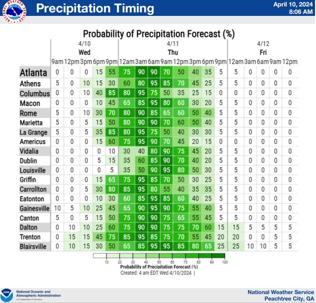
Thunderstorms and rain showers should push back into the region this evening and linger into Thursday.
The core of the heaviest rainfall and peak severe weather threat should occur tonight and Thursday morning.
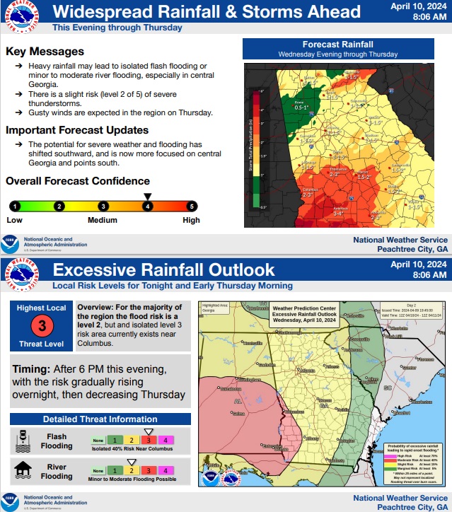
There is currently a Slight Risk (Level 2 of 5) for severe weather in central Georgia.
The flooding threat is also highest in central Georgia.
The Atlanta metro should be on the northern periphery of the severe weather and flooding threat.
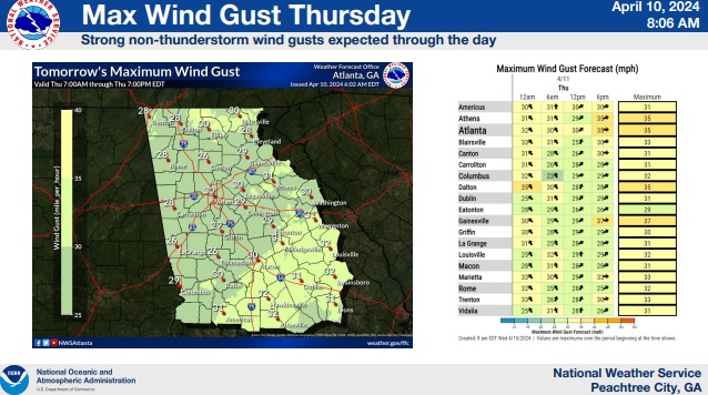
Gusty “non-thunderstorm” winds may also develop tonight and linger through Thursday afternoon.
WHAT:
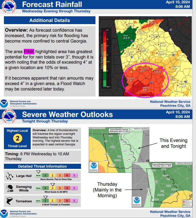
- Rainfall totals between 1 and 3 inches are expected in the region, with isolated higher amounts possible in central Georgia.
- Isolated flash flooding and/or minor to moderate river flooding may occur.
- A line of strong to severe storms should move into the region this evening and linger into Thursday morning. The primary hazards with any storms will be damaging winds gusts to 60 mph or a brief tornado.
- Non-Thunderstorms wind gusts between 30 and 35 mph, with gust near 45 mph possible along the mountain ridgelines.
WHERE & WHEN:
- All of the region could be impacted, but the severe weather and flooding threat is highest in central Georgia.
- The greatest risk for severe weather and flooding will be between 6 PM this evening an 10 AM Thursday.
- Gusty winds will develop tonight and linger through Thursday afternoon.
IMPACTS:
- The heavier rain could lead to localized FLASH FLOODING (rapid rise of water in a short period of time) in addition to an elevated risk of river/stream flooding.
- Damaging thunderstorm winds (or tornadoes) could bring down trees and powerlines.
- Non-thunderstorm winds (< 45 mph) could also bring down trees and powerlines due to saturated grounds and persistent wind gusts Wednesday night into Thursday.
FORECAST CONFIDENCE:
- Medium confidence in the rainfall forecast and flood threat.
- Medium confidence in the level of the severe threat.