Monday, April 1, 2024–10:11 a.m.
-National Weather Service-
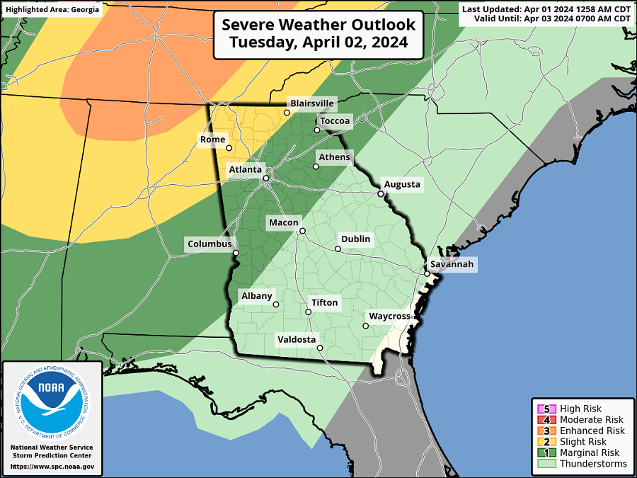
A strong cold front advancing into north Georgia on Tuesday evening will bring a round of thunderstorms into the area.
There is a Slight Risk (level 2 out of 5) for severe thunderstorms in portions of northwest Georgia immediately ahead of the front.
The cold front and associated thunderstorms will advance south and east through the overnight hours into early Wednesday morning, at which point the severe threat will diminish to a Marginal Risk (level 1 out of 5) with weakening instability.
WHERE & WHEN:
- Thunderstorms move into northwest Georgia after 5 PM Tuesday, with the greatest severe thunderstorm threat expected between 7 PM and 11 PM in northwest Georgia.
- After 11 PM, and before reaching the Atlanta metro area, the threat for severe storms will begin to diminish with the loss of instability, although a few storms may still become strong to severe.
- Showers/thunderstorms will come to an end early Wednesday morning as the cold front moves into southeast Georgia.
IMPACTS:
- Severe thunderstorms that develop will be capable of producing:
- Damaging wind gusts
- Hail up to 1″
- A brief, isolated tornado cannot be ruled out.
- Rainfall totals are forecast to range from 0.5 to 1 inch along north of I-20 and from 0.25 to 0.5″ south of I-20.
- Stronger storms could produce locally higher rainfall amounts.
FORECAST CONFIDENCE:
- MEDIUM confidence in the timing and extent